


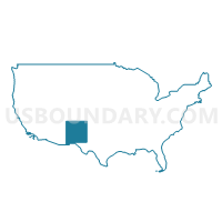
Southwest New Mexico PUMA, New Mexico
About
Outline

Summary
| Unique Area Identifier | 193443 |
| Name | Southwest New Mexico PUMA |
| State | New Mexico |
| Area (square miles) | 31,538.78 |
| Land Area (square miles) | 31,457.84 |
| Water Area (square miles) | 80.93 |
| % of Land Area | 99.74 |
| % of Water Area | 0.26 |
| Latitude of the Internal Point | 33.39573010 |
| Longtitude of the Internal Point | -107.62141950 |
Maps

Graphs
Select a template below for downloading or customizing gragh for Southwest New Mexico PUMA, New Mexico


Neighbors
Neighoring Public Use Microdata Area (by Name) Neighboring Public Use Microdata Area on the Map
- Central Southeast New Mexico PUMA, NM
- Cochise & Santa Cruz Counties--Sierra Vista City PUMA, AZ
- Doña Ana County (Outer) PUMA, NM
- Eastern Plains New Mexico PUMA, NM
- Gila, Graham, Greenlee & Pinal (East) Counties PUMA, AZ
- Navajo & Apache Counties PUMA, AZ
- North Central New Mexico PUMA, NM
- Northwest New Mexico--Navajo Nation PUMA, NM
- Santa Fe County PUMA, NM
- Valencia, Bernalillo (East Mountains) Counties & Isleta Pueblo PUMA, NM
Top 10 Neighboring County (by Population) Neighboring County on the Map
- Bernalillo County, NM (662,564)
- Doña Ana County, NM (209,233)
- Santa Fe County, NM (144,170)
- Cochise County, AZ (131,346)
- Valencia County, NM (76,569)
- Apache County, AZ (71,518)
- Otero County, NM (63,797)
- Grant County, NM (29,514)
- San Miguel County, NM (29,393)
- Cibola County, NM (27,213)
Top 10 Neighboring County Subdivision (by Population) Neighboring County Subdivision on the Map
- Los Lunas CCD, Valencia County, NM (55,761)
- Santa Fe South CCD, Santa Fe County, NM (39,958)
- Doña Ana-Hill CCD, Doña Ana County, NM (36,217)
- South Doña Ana CCD, Doña Ana County, NM (26,162)
- Deming South CCD, Luna County, NM (20,997)
- Belen CCD, Valencia County, NM (20,808)
- Grants CCD, Cibola County, NM (20,500)
- East Bernalillo CCD, Bernalillo County, NM (19,056)
- Silver City CCD, Grant County, NM (16,948)
- Socorro CCD, Socorro County, NM (14,354)
Top 10 Neighboring Place (by Population) Neighboring Place on the Map
- Deming city, NM (14,855)
- Silver City town, NM (10,315)
- Socorro city, NM (9,051)
- Truth or Consequences city, NM (6,475)
- Meadow Lake CDP, NM (4,708)
- Edgewood town, NM (3,735)
- Lordsburg city, NM (2,797)
- Bayard city, NM (2,328)
- Moriarty city, NM (1,910)
- Santa Clara village, NM (1,686)
Top 10 Neighboring Elementary School District (by Population) Neighboring Elementary School District on the Map
- Alpine Elementary District, AZ (463)
- Apache Elementary District, AZ (166)
- Blue Elementary District, AZ (37)
Top 10 Neighboring Unified School District (by Population) Neighboring Unified School District on the Map
- Albuquerque Public Schools, NM (667,445)
- Las Cruces Public Schools, NM (149,482)
- Gadsden Independent Schools, NM (62,675)
- Los Lunas Public Schools, NM (48,173)
- Belen Consolidated Schools, NM (30,853)
- Grants-Cibola County Schools, NM (27,088)
- Deming Public Schools, NM (25,095)
- Moriarty Municipal Schools, NM (23,044)
- Douglas Unified District, AZ (21,931)
- Silver City Consolidated Schools, NM (21,377)
Top 10 Neighboring State Legislative District Lower Chamber (by Population) Neighboring State Legislative District Lower Chamber on the Map
- State House District 25, AZ (208,220)
- State House District 5, AZ (192,258)
- State House District 53, NM (36,271)
- State House District 50, NM (31,808)
- State House District 20, NM (31,358)
- State House District 49, NM (31,024)
- State House District 34, NM (29,955)
- State House District 22, NM (29,758)
- State House District 7, NM (29,350)
- State House District 8, NM (28,864)
Top 10 Neighboring State Legislative District Upper Chamber (by Population) Neighboring State Legislative District Upper Chamber on the Map
- State Senate District 25, AZ (208,220)
- State Senate District 5, AZ (192,258)
- State Senate District 37, NM (66,562)
- State Senate District 29, NM (50,755)
- State Senate District 36, NM (48,503)
- State Senate District 30, NM (48,188)
- State Senate District 39, NM (48,118)
- State Senate District 40, NM (46,725)
- State Senate District 38, NM (46,281)
- State Senate District 19, NM (45,690)
Top 10 Neighboring 111th Congressional District (by Population) Neighboring 111th Congressional District on the Map
- Congressional District 1, AZ (774,310)
- Congressional District 8, AZ (754,300)
- Congressional District 1, NM (701,939)
- Congressional District 3, NM (693,284)
- Congressional District 2, NM (663,956)
Top 10 Neighboring Census Tract (by Population) Neighboring Census Tract on the Map
- Census Tract 9703.01, Valencia County, NM (7,334)
- Census Tract 9636, Torrance County, NM (6,854)
- Census Tract 9643, Grant County, NM (6,777)
- Census Tract 9747, Cibola County, NM (6,660)
- Census Tract 13.07, Doña Ana County, NM (6,369)
- Census Tract 7, Otero County, NM (6,143)
- Census Tract 15, Doña Ana County, NM (6,119)
- Census Tract 4, Luna County, NM (5,936)
- Census Tract 9647, Grant County, NM (5,891)
- Census Tract 17.01, Doña Ana County, NM (5,842)
Top 10 Neighboring 5-Digit ZIP Code Tabulation Area (by Population) Neighboring 5-Digit ZIP Code Tabulation Area on the Map
- 87031, NM (44,075)
- 88012, NM (25,961)
- 88007, NM (24,048)
- 88030, NM (23,222)
- 87002, NM (22,517)
- 85607, AZ (18,925)
- 88061, NM (18,585)
- 88021, NM (18,421)
- 87015, NM (13,105)
- 87020, NM (11,347)